
TOP 10 Reasons


Circle sierra
Ride around the sierra
Mountain RangE


Highlights: Highway 190 • Western Divide Highway • Sherman Pass • Nine Mile Canyon • Whitney Meadows Rd • Horseshoe Meadows Rd • Manzanar Japanese Gardens • Horseshoe Meadows Rd • Whitney Portal Rd • Onion Valley Rd • Highway 168 • White Mountain Rd • Ancient Bristlecone Forest • Highway 168 • Lake Sabrina • Pine Creek Rd • Lower Rock Creek Rd • Hot Creek Geologic Site • Benton Crossing Rd • Highway 120 East • Mono Lake Tufa Towers • Highway 158-June Lake Loop • Highway 89-Monitor Pass • Highway 4- Ebbetts Pass • Bear Valley
When was the last time you got on the bike and just left?
No plan, no direction. Just a couple bucks for gas money and a block of time to do nothing but just ride. You remember the sensation as glorious! Rolling through wide open countryside, with nearby mountain peaks offering endless curves to fill the day. It was relaxing, carefree and just the medicine you needed. You rode off into the horizon to decompress, detach. And it delivered.
How long ago was that? 5 years? A decade?
Remember what you said?
You swore you'd do it again first chance you got. But then life got in the way, schedules, deadlines, expectations, someone to answer to. Progress reports, TPS Reports, The boss. (Maybe you are the boss) What have you done for me lately? What are you going to do for me tomorrow? What are your projections for what you're going to accomplish in the next quarter, the next month, next cycle?
Ready to leave all that behind?
We too. And we've got just the thing.
Circle Sierra...
Ready to leave all that behind?
Ready to get back to Glorious: We are too.
And we've got just the thing.
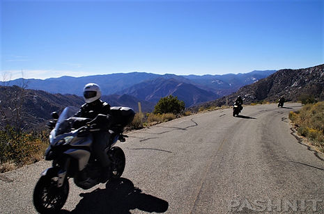
Circle Sierra reaches out and gives the Sierra Nevada Mountains a generous embrace, taking in the very best roads, including some new ones. Open desert, mountain passes, remote mountain valleys, views that stretch for miles and to top it off, we'll ride the highest elevation paved road in California at over 10,000 ft. It's the ride you've been longing for. The escape you've been dreaming of. Leave TPS Reports behind and come ride with us, feel the open road, the endless road, the majesty, the camaraderie of friends who share The Love of The Ride as much as you do.
Circle Sierra starts in the Sierra Nevada Foothills and rides up and over the Sierra Nevada Range falling off into the wide-open spaces of the Eastern Sierra. There's no traffic, no people, no bosses, no expectations, just endless scenery.
The more you ride with Pashnit Motorcycle Tours, the more you’ll hear this phrase, ‘Endlessly Twisty’. What's our day going to be like? Endless Twisty. Where are we headed? Does it matter? Mount up, let's ride.
Spades...
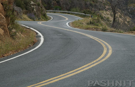
Highway 190 is the southernmost high mountain pass when combined with Sherman Pass. We start off the weekend with one of the twistiest roads in the state. What Highway 190 has in spades is curves. And many. I’ve never met a motorcyclist who doesn’t react like a giddy schoolkid when that particular description is used to describe the prospective ride for the day at our morning ride brief.
Highway 190 has one of the twistiest stretches of road in the state, meaning as in many curves packed into a defined stretch of road. While I’ve never counted, common knowledge claims 250 curves in 25 miles. Maybe someone did count them. But counting curves doesn’t tell a story.
Our story starts five miles outside Springville when Highway 190 reaches the Tule River. The first double hairpin appears and our climb into the Sierra Range begins. The elevation bumps past 2000 ft and will climb to 7200 ft in less than 20 miles of non-stop uninhibited curves. The temperature drops 8-12 degrees for every 4000 ft of climbing in elevation, and the cool temps are always a welcome respite from the Central Valley.
The curves for the next 20 miles are like a restless child, a cadence of curve, constant, endless. Road surface is excellent with minimal sand in the road from vehicles cutting corners. The view begins to open up on the Tule River Canyon. Carpeted hillsides on the south side of the canyon push up thousands of feet, while granite boulders and raw escarpments rise up along the north side. The rapid-fire curves continue another 9 miles, while climbing another 2000 ft to reach Quaking Aspen beyond Cedar Slope.
As Highway 190 reaches Quaking Aspen, the tight twisties ease up and the road takes a breather, relaxes, turning south along the spine of the Sierra. This section is known as the Western Divide Highway or Mountain 90. The trek south is fast, with repeating broadly arcing curves. Several long straights provide a vantage point that extends far off into the forest.
When you see a pullout on the east side of the road, stop and take in the view. The view eastward is often a broad mountain top viewpoint looking down on the Kern River Canyon, several thousand feet below. It’s worth the stop instead of blowing right on by.
It’s also worth noting the 400-mile-long Sierra Nevada Range is drawing to a close here as you ride the very southern spine of the range. More interestingly, the Southern Sierra is split into the shape of a fork with the Kern River Canyon below having cut the range in half dividing it into two prongs.
Dome Rock looks across the Wild & Scenic Kern River to the expansive Kern Plateau. At the right time of year during spring snowmelt, you can see waterfalls pouring down the range across the Kern River Valley. Last time I was here, it started snowing while I was there atop the dome. And just up the road - sequoia trees- The Trail of 100 Giants.
Sherman Pass...
Sherman Pass spans 67 miles from the Kern River Canyon to Highway 395, and fuel stops have to be planned carefully if you have a low-mileage bike in the 120-mile range. The sign at the start of Sherman Pass reads "Next Fuel 75 Miles". Fuel is available in Kernville, but Sherman Pass is located 20 miles north up the river canyon from Kernville. The total ride from Springville over Sherman Pass to Highway 395 is just shy of 120 miles to fuel. Prudence says be prepared.
There is an above ground fuel tank at the halfway mark at Kennedy Meadows, but (1) you’re assuming they have fuel, and (2) they’re open, and (3) they have power. There is no electricity in Kennedy Meadows, this community is off-grid, and the business runs off a portable generator. Gas here is expensive, but you may elect to top off a gallon or two for peace of mind
The Kern Plateau, at the southern tip of the Sierra Nevada Mountains, is a remote, high elevation plateau offering a retreat from the heat of summer for almost any outdoor recreation activity, especially for dirt bikes. Trails spider off in every direction. Consisting of more than 950 square miles, the Kern Plateau has served as a summer destination for generations of dirt riders.
Remember that part about this region being a plateau? It’s generally flat, which also means the road is flat, meandering through the sagebrush which on the right day, has a very distinct sweet smell. For many people, sagebrush has become one of the defining smells of the western United States. Writers such as Mark Twain and John Muir commented on its distinctive fragrance, and countless travelers have associated it with wide-open basins, mountain passes, and desert landscapes.
Speeds are fast and smooth until Sherman Pass reaches Nine Mile Canyon. While the ride is two lane and smooth, Nine Mile Canyon drops 3000 feet in the last 10 miles to Highway 395. The ride here is fast, twisty, and wide open.
The wide-open nature of the road invites speed, headed up, or headed down. While there are several long stretches of guard rails, most of the ride has few if any barrier between you and the canyon below. In addition, this is a desert, so keep an eye out for sand in the road. You can see a long way off down the canyon wall, and you’re able to see opposing traffic headed for you a long way off.
Halfway down the canyon, the Los Angeles Aqueduct pops out of the ground, bounces across the canyon, and then disappears again into the ground. The road cut visible on the other side of the canyon curls around the hillside and rejoins with the aqueduct on the other side of the mountaintop. Joshua Trees line the sparse hillsides at certain elevation bands.
Spider Roads...
The Eastern Sierra Nevada might not rank high on your list for a motorcycle tour. It's dry. It's a desert. It's boring. It's in the rain shadow of the Sierra range. The roads are long and straight. Doesn't sound fun?
But there's something unique and magical about the Eastern Sierra. Wide open spaces punctuated by mountain peaks on both left and right. It's beautiful. Majestic. This region of the Sierra Nevada Mountains also has something you can find nowhere else in the state.
Ever heard the term Spider Roads? No?
Decidedly Pashnit terminology?
Horseshoe Meadows Rd is one such road, a dead end that detours off the main route like the legs of a spider. Highway 395 will be the body of our spider as we repeatedly head into the Eastern Sierra Nevada mountain valleys.
Mt Whitney is the highest peak in the Lower 48. As we ride partway up to the trailhead, the valley floor drops away and it feels like we’re headed straight up the mountain side. It feels that way because we are. While switch-backing up the side of the mountain climbing rapidly, the view of Lone Pine & the Owens Valley far below is positively amazing.
White Mountains: 4700 years later..
Atop the White Mountains along the CA-NV border at 10,000 feet are the oldest trees in the world. Gaining 3000 ft in 12 miles, White Mountain Rd leaves Highway 168 and climbs up to 10,000 ft, the highest paved road in the state. Climbing through multiple switchbacks to reach the Sierra View Overlook at the 9300 level, and we haven’t even reached the top yet. The unobstructed views here are wide open looking down on the Owens Valley and the Eastern Sierra Range.
And just up the road atop the White Mountains are the oldest (non-clonal) living things on earth. The most common things our riders say - I had no idea this was here! That's because you'd never know this ancient forest is even there. White Mountain Rd leads high into the White Mountains where passing the 10,000-foot sign—with the pavement still climbing—feels like arriving at the roof of the world, looking out over the Sierra Nevada.
What's at the top? The Ancient Bristlecone Pine Forest - 3000-year-old trees that have a remarkable ability to survive in an extremely harsh and challenging environment. In fact, bristlecone pines are recognized as the oldest non-clonal living organisms in the world, with lifespans approaching more than 5,000 years.
Nearly 20 trees here have been dated to over 4000 yrs old, and the world’s oldest tree location is said to be kept secret. Coring samples are said to have dated the tree as high as 5070 years old. When Columbus crossed the Atlantic Ocean, these trees were already 4000 years old.
Ready for more spiders? Thank you Sir, may I have another. Highway 168 reaches out to Aspendell, a tiny mountain community at the 8400 ft level on the other side of the Owens Valley. However, continue into the Sierra Range once the road opens up and you’ll reach Lake Sabrina at the 9100 ft level. And it’s not a lake, rather a reservoir built in 1907 as part of many hydroelectric projects of that time period.
This lake is famous for fall colors, especially as the aspen groves around Aspendell & Lake Sabrina turn a brilliant golden color in late September/early October. They also have apple pie. There’s a tiny restaurant and tables overlooking Lake Sabrina providing a mountain valley vista the Eastern Sierra is especially known for.
Sagehen Summit. 8139 ft....
The eastern reaches are known for whoops. The sort of whoops that you pop over and the bike instantly drops so quickly it pushes your heart up to where your eyeballs are. Not done yet. There's another, then another. The whoops are great fun and the best part of this section of Highway 120, is flowing up and over 8139 ft Sagehen Summit -it all leads to Mono Lake.
Mono Lake...
Dip your fingers in the water of Mono Lake. It feels like soap. The high salt content creates an elevated buoyancy. You can swim in Mono Lake, and it’s also a favorite of kayakers to gently float along the shore. Mono Lake has no natural outlet, water only leaves via evaporation leaving behind the salt. The yearly evaporation rate is approximately 45 inches per year, meaning the lake level seasonally rises up and down nearly 4 feet. There are no fish, and you might assume it is a dead lake, conversely Mono Lake is considered one of the most productive ecosystems in the world.
The high salinity has created an ecosystem based on brine shrimp thriving in the alkaline waters. The brine shrimp in turn provide sustenance for migratory birds including 50,000 California Gulls, another 4M migratory birds, and billions of alkali flies. Tufa Towers (pronounced "too-fa") line the walkway to the lake shore and protrude up from the water’s edge, unlike anything you may have seen. These Tufa Towers can only form one way.
Calcium-rich water bubbling up from underwater springs combine with carbonate-rich water in a chemical reaction, creating the lime-based structures. The towers can reach a height of 30 feet. The tufa towers were at one time all underwater, but are visible today due to the dramatic drop in the lake level since the 1940s.
If it’s the correct season, the shoreline is black- and moving. Walk toward this black color and a cloud of alkali flies erupt from the ground. They fly up unconcerned with you and settle back to the shore line more interested in consuming the algae. They line the shoreline and also float on the water. The alkali flies lay their eggs underwater, the larvae hatch, then develop underwater, eventually emerging and walking from the water onto the shore. This abundance of flies creates an ecosystem feeding off these insects. California Gulls are plentiful, feeding off the flies. Native Americans in the region also consumed the alkali flies as part of their diet.
Monitor, Ebbetts & Bear Valley...
A few years ago, a group of motorcyclists developed a rating system for roads to rank them from best to not so best. They added in all the pertinent mathematical formulas, twistiness, pavement, engineering, scenery, remoteness and finally, character. In the end, they compared them all, every road in California. They then added up the mathematical score and came out with a clear winner. The authors named Highway 89 Monitor Pass as the best motorcycle road in the state of California. Riders were either pleased or surprised. What about Road X, or Road Y? Those are better. I have to admit that as a connoisseur of roads for motorcyclists, I never wanted to create a rating system for roads. You have to decide for yourself.
The title of this tour involves the word, "Circle", and here's where we begin to close the loop. Highway 89 begins to curl up to the summit through several increasingly faster S-curves, gaining elevation steadily without any tight hairpins. It is hard not to gape at the view as there are few trees and the view is a wall of mountain peaks. It’s hard to resist the temptation to stop at every overlook on Highway 89. Sight lines are broad and you can see up the hillside at any approaching traffic as you climb.
Curves here are smooth steady affairs of unfiltered puppy dog happiness. Pavement is dreamy smooth and often rather clean with a slightly wider stance allowing truck wheels to stay on pavement without kicking up rocks onto the road. At the top of the hill is a broad paved pullout with a remarkable view of Slinkards Valley.
One of the most striking vistas in all of California Motorcycle Roads presents itself as you climb level with Slinkards Valley. One can’t help but pull over and attempt to absorb the scene as best as the brain can comprehend. There’s a paved pullout here that is the perfect place for a photo. It’s too easy to park and take a quick snap of Slinkards Valley and continue your journey, but a few more minutes of time encourages an attempt to absorb the tremendous view.
Bear Valley...
A few years ago, I wrote a rather long-winded highly comprehensive article about Highway 4-Ebbetts Pass. Long-winded as in it's 25 pages of text and photos. There's a lot going on and a lot to see along the way. But the best part of this 90 miles of mountain curves is the 23 miles of narrow single-lane at the double summit section of Pacific Grade and Ebbetts Summits. The group is headed to spend the night at Bear Valley.
Our tour of the Sierra Nevada wraps up at the top of the range at the Bear Valley Ski Resort. Originally known as Grizzly Bear Valley, Bear Valley dates to 1855. This narrow bowl-shaped valley sits at the end of the narrow single lane climb across the crest of the Sierra Range. Bear Valley Mountain reaches a summit of 8500 ft, with a base of 6600 ft. In the late 1950s, the land was developed, along with Highway 4 into the valley. By 1967, the Skyline Bear Valley mountain resort opened, although the ski runs are all on the backside of the mountain facing north and can’t be seen from the highway.
The small ski village community is on the south side of the mountain, facing Highway 4. The ski hill has a broad panoramic view of the Mokelumne River Canyon below Bear Valley Mountain with Mount Reba summit elevation at 8736 ft.
By the time you roll into Bear Valley and shut off your engine, the true meaning of "Circle Sierra" becomes clear. You’ve carved the non-stop twisties of Highway 190, barrelled down Nine Mile Canyon, climbed to the literal roof of California among ancient bristlecones, and swept through the sublime mountain passes of Monitor and Ebbetts.
What began as a simple desire to escape the daily grind leaves you rich with 1,000 miles of shared stories, worn tire edges, and an undeniable sense of accomplishment. You didn't just ride the Sierra Nevada Range—you embraced it, closed the loop, and rode away with a brand-new definition of what a motorcycle tour ought to be.
quick ride
Tour: September 03-06, 2027
Meet: 218N Highway 65, Lindsay, CA
Arrive: 7:00 AM, Safety Brief 7:30, Depart 8:00 AM
Cost: $540 per rider, $119 Passenger
ROADS:
This tour includes narrow single lane paved mountain roads. The ride includes steep grades and negotiating steep hair-pin mountain corners. All roads on this tour are paved.
EXPERIENCED RIDERS ONLY:
This tour is not recommended for beginner riders or Very Large Motorcycles. Riders are expected to have at least several years of enthusiastic experience on their motorcycle riding remote challenging paved mountain backroads along with at least 5000+ miles of concurrent recent experience.
HIGH DEMAND:
This tour is limited by the amount of rooms at our host lodging. We have booked rooms months in advance and our tours sell out by the end of January. Get on our mailing list to be the first to know about new rides. Tours are planned & announced in the late fall of each year.
Book early to ensure a spot on this new ride. Check with us to see if any available spots are open. Some of our rides may have waiting lists to be able to join the group.
MORE DETAILS:


.jpg)


Starts Sep 3, 2027
540 US dollarsLoading availability...
Loading availability...